
Burlington Planning Guides
Landscaping Near Conservation Halton Regulated Areas & the Niagara Escarpment
Screen Burlington landscaping near creeks, ravines, shorelines and the Escarpment by separating City, Conservation Halton and NEC requirements.
A backyard near a natural feature can have questions that are not answered by a standard paving or deck quotation. Grading, excavation, retaining work, temporary fill, a pool, a fence or an access route may need review because of where the activity occurs. The relevant location is the work area and its effects, rather than a neighbourhood name alone.
This guide separates three enquiries: municipal requirements, Conservation Halton regulation and Niagara Escarpment development control. They can overlap, but they do not apply identically to every Burlington property. Use the official mapping and authority confirmation to establish the actual context before treating a general landscape idea as ready for construction.
Different authorities answer different questions
| Authority or process | Initial screening question | What it does not settle |
|---|---|---|
| City of Burlington | Which zoning, building, site-alteration, tree and road-interface requirements apply? | A municipal answer does not automatically establish agency permission. |
| Conservation Halton | Is the proposed activity in an area regulated under its current framework, and what review is needed? | A conservation-authority answer does not replace municipal zoning or building review. |
| Niagara Escarpment Commission | Is the site in the relevant Plan or Development Control area, and does the actual work require a permit? | An NEC exemption does not remove other applicable requirements. |
| Other property interests | Are there easements, shared features, woodland rules or private permissions to address? | Property consent does not authorize work under public regulation. |
Locate the proposal within the property and natural setting
Begin with the address, a survey if available and a sketch showing the intended work. Mark the house, boundaries, existing structures and the access route. Include nearby creek channels, wooded slopes, shoreline or low-lying natural areas visible from the site. These observations help frame an enquiry, but they do not establish a legal regulated boundary by themselves.
A natural feature can affect more ground than its obvious water or vegetation edge. Flooding, erosion, slope conditions or associated regulated lands may be relevant. Equally, a wet patch in a lawn is not enough to identify a legally defined wetland. Avoid drawing a fixed buffer around every damp place or assuming a fence marks the limit of agency jurisdiction.
Use official maps as a screening step and provide the authority with the proposed work location. A broad parcel may contain both affected and unaffected areas. A garden at the house, an access route along the side and a stockpile near the rear boundary are different activities in different places. Show them separately so the response addresses the full construction envelope.
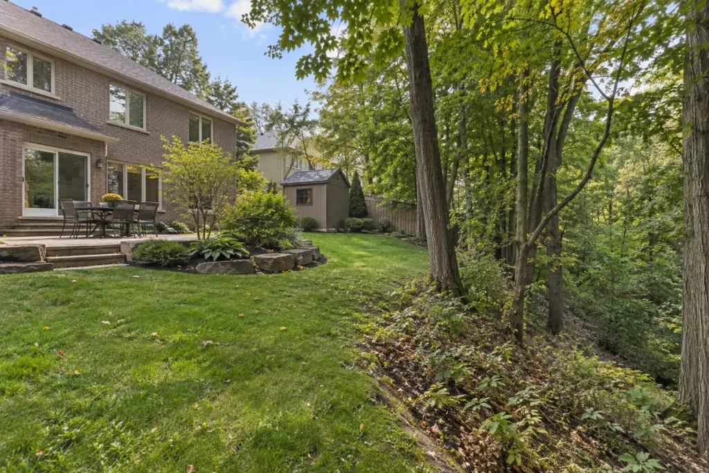
Photographs should connect close details to the wider setting. Include a view from the house toward the natural edge, the proposed excavation area and the route equipment would take. Where grade changes are proposed, appropriate existing and proposed level information may be needed. A cropped image of the proposed patio alone does not show how it relates to a slope or drainage corridor.
Conservation Halton: ask about the activity, not just the finished feature
Conservation Halton’s permitting framework includes development activities such as site grading and placing or removing material, as well as structures. That makes the temporary works important. A final patio may occupy a modest footprint, while excavation, fill storage and machinery access affect a wider area near a slope or watercourse.
Use its current mapping and permitting information to ask whether the proposed work area is regulated and what the next step should be. Describe the size, location and nature of the change accurately. Replacing a surface within its present footprint, enlarging it, changing surrounding grades and adding a retaining wall are distinct proposals. Calling all of them maintenance can obscure the information needed for a useful answer.
Some activities have conditional exemptions under the current regulation. The conditions matter together: the type of feature, location and other limitations cannot be reduced to a single small-project size. Obtain confirmation where needed before relying on an exemption. A conservation-authority exemption is not a general statement that no permit or other permission is required.
Keep regulatory screening separate from broader planning or natural-heritage requirements. Different processes can use different boundaries or considerations. Do not use one distance found online as a universal setback for every creek, wetland, ravine or shoreline project. Ask the authority which information is needed for the actual site, including any surveys, levels or technical studies it identifies.
Keep access away from a natural drainage corridor
A work route can be more consequential than the completed garden. Repeated equipment movement, temporary bridging, soil piles or removed vegetation may affect a drainage corridor or slope even if the new feature is closer to the house. Show the proposed route and staging area during screening rather than assuming they are incidental.
If the usable access is constrained, adjust the project concept and construction method before booking deliveries. Smaller equipment does not automatically eliminate an approval issue, and a temporary operation is not automatically outside the rules. The practical response is to define what will happen, where it will happen and what protection or review is required.
Niagara Escarpment: distinguish the map layers and current exemption test
The NEC directs owners to check the Niagara Escarpment Plan Area and the Area of Development Control. Those terms should not be treated as interchangeable with north Burlington or with every rural property. Its map is an initial aid, while accurate boundary interpretation may require confirmation. A property description in a real-estate listing is not a permit determination.
Grading and imported soil can be part of the development question, so a project without a new building may still need screening. Explain all parts of the proposal, including walls, patios, decks, pools, fencing and changes to access. Where several features are connected, avoid asking about one small component while leaving the related land alteration out of the enquiry.
Exemptions should be assessed against the current regulation and actual design. Older self-assessment examples may remain visible while agency information is being updated. Keep a record of the advice or applicable assessment used for the project and confirm what happens if the footprint, height or grading later changes. A previous permit on the property does not necessarily authorize a different proposal.
Municipal and agency sequencing should be clarified before materials are ordered. Ask what information each authority needs and whether another review must be completed first. This is a coordination question, not a promise that every application can be made at once. Required professional plans or studies should be understood while the budget and scope can still be adjusted.
Current agency sources and the 2026 NEC change
Conservation Halton identifies Ontario Regulation 41/24 as its current regulation. Use its mapping and permitting process to screen the proposed activity.
Ontario’s current Regulation 828 consolidation is effective from July 6, 2026, following amendment 225/26. The NEC deck self-assessment page still displays an updating notice. Confirm current exemptions with the law and NEC staff instead of relying on older numeric examples.
- Conservation Halton: Permitting
- Conservation Halton: Mapping and Studies
- Ontario: Regulation 828
- NEC: Development Permit Applications
Information reviewed:
Prepare a clear screening enquiry
Identify the location
Provide the address, survey or available base plan and the proposed work area. Show the natural feature context and distinguish the parcel boundary from any mapped agency boundary.
Describe the complete change
Include excavation, fill, removal, access, stockpiles, structures and the intended drainage route. State what remains and what is being replaced or enlarged.
Ask for the next applicable step
Confirm jurisdiction, required application or exemption assessment and supporting information. Clarify whether qualified surveys, engineering, arborist advice or other studies are needed.
Keep the construction scope consistent
Use the reviewed plan to define the work. If access, dimensions or grade change later, confirm the effect before proceeding. Share the current requirements with everyone responsible for the affected work.
Questions to settle before work begins
Does every Burlington yard need Conservation Halton approval?
No blanket conclusion should be made from the city name. Applicability depends on the location and activity. Use official mapping and the authority’s screening process for the proposed work area, including temporary construction activities.
If the City says no building permit is needed, can landscaping begin?
That answer addresses one process. Zoning, site alteration, tree, right-of-way and applicable agency requirements may still need resolution. Describe the same complete proposal to the relevant authorities before treating a building-permit exemption as permission for all work.
Can a landscaper confirm that my project is exempt?
A landscaping discussion can identify questions and help define the intended scope. It does not replace the applicable authority’s interpretation, qualified professional information or the owner’s responsibilities. Confirm the actual exemption conditions and other required permissions before construction.
Discuss the changes you are considering
Share the property conditions, the improvement you want and any existing survey, drawings or approval information. Photos of the whole work area help connect the proposal to its surroundings.
Tell us what you would like to change, repair or maintain around your property.